

I came across a very interesting site the other day called the Extreme Resolution that used an interface based on Google Maps to view and zoom in on massive images (hundreds of megapixels in size). Because I had experimented with the Google Maps API in the past, I thought to myself, "Hey, I can do this!". So I dug around a lot and did some research on implementing custom tiles with Google Maps. While originally intended to support layering 3rd party maps on top of Google Maps, I realised this was something readily adaptable for my intentions.
After a week or two of trying to establish how best to manage an image and cartesian coordinates I came up with a working model. In fact, I can process any large image to work with Bigapixel viewer in a matter of minutes.
The name "Bigapixel"sort of popped into my head as a way to describe images that are obviously well over a megapixel (1024x1024 pixels) but not quite a gigapixel (32000x32000 pixels). I would wager that any panorama that I could possibly ever generate would fall somewhere in that range.
My usual photography can be viewed at my photography site or at Flickr.
1200x800 (~1 Megapixel):  3076x2048 (6.3 Megapixels):
  40000x27000 (1 Gigapixel):
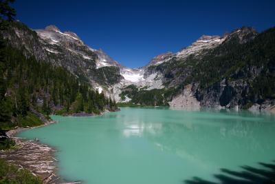
At this time please consider these to be demonstration-quality results, I hope to further improve the usibility of the interface as I find the time.
 |
A nightime panorama of the Seattle skyline 28 Megapixels
|
 |
Seattle from Victor Steinbrueck Park A another view of Seattle 90 Megapixels
|
 |
A small panorama of a famous Washington landmark with some fall color 14 Megapixels
|
 |
A single-row panorama of a scenic marina in the San Juans 26 Megapixels
|
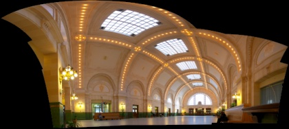 |
King Street Station, Seattle, Washington A stitch of horizontal and vertical elements 38 Megapixels
|
 |
From our Great American Road Trip. 64 Megapixels
|
 |
Boeing Factory, Everett, Washington Two dreamliners and a 777F 30 Megapixels
|
 |
Boeing Dreamliner One, Everett, Washington The first Boeing Dreamliner (787) 32 Megapixels
|
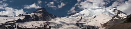 |
Looking up Emmons Glacier 130 Megapixels
|
More to come soon...